Field notes
River lore & a little history.
The first descent, the canyon that drowned, and what the gauges inherited.
From Desolation Canyon to the canyon that drowned.
The living laboratory
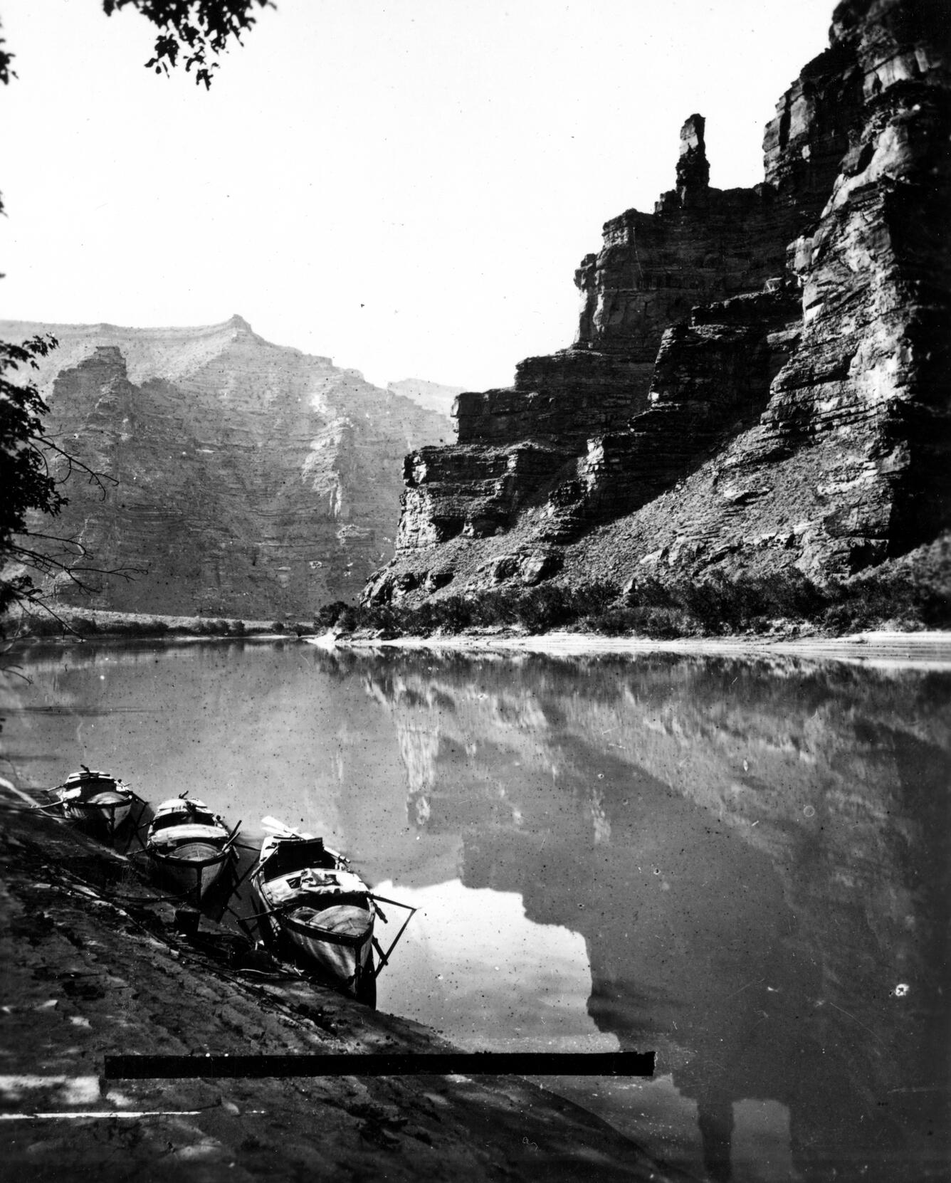
When John Wesley Powell entered the Canyon of Desolation in the summer of 1869, he was moving through what is now Emery and Carbon Counties, 85 miles of canyon with no roads in or out. He named it not for hostility but for isolation: no settlements, no trails, no visible sign of anything built by human hands. More than 150 years later, Desolation Canyon remains one of the longest roadless river corridors in the contiguous United States.
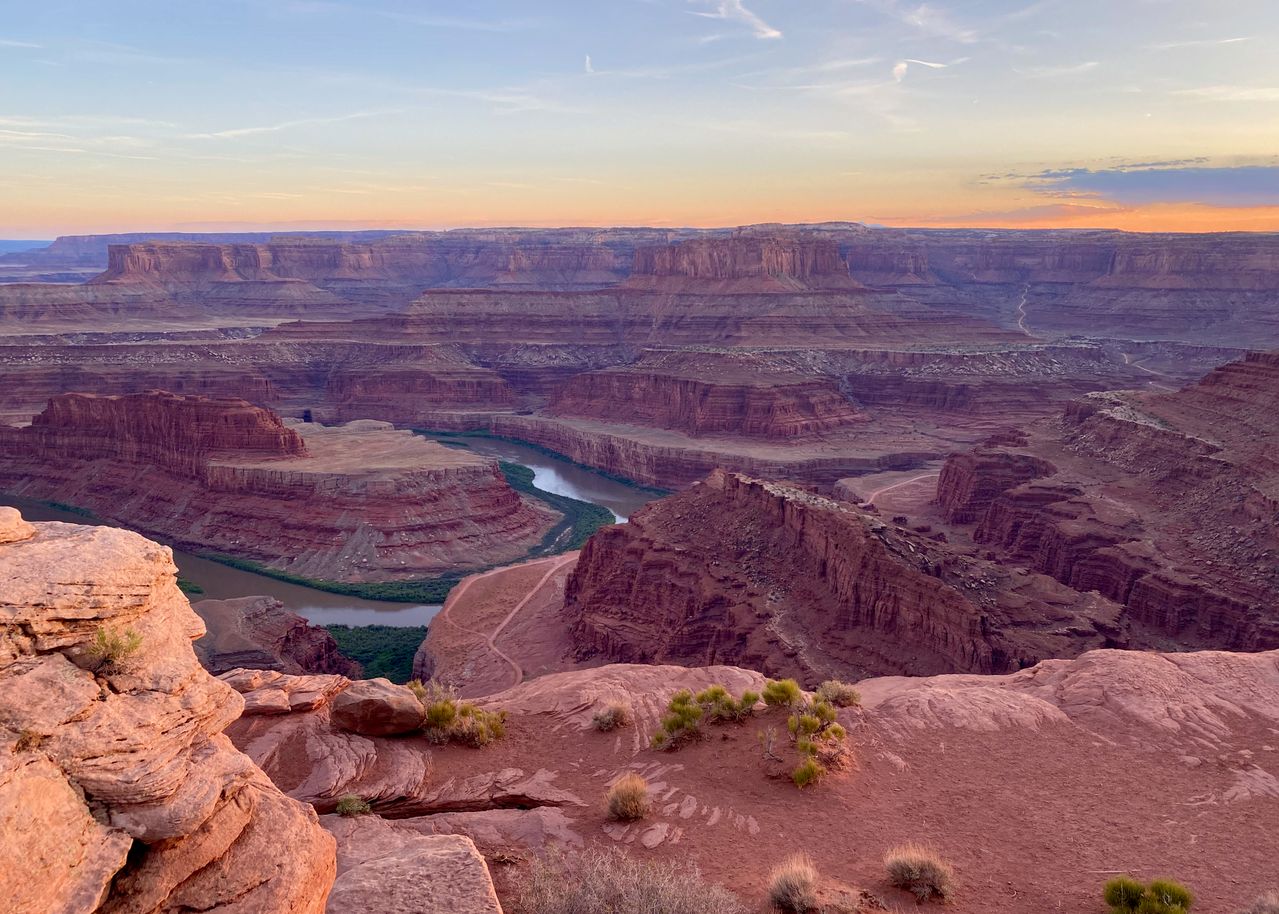
Below Gray Canyon the river opened briefly at the town site that now bears its name, then bent south toward the confluence. At the point where the Green meets the Colorado, in what is now the heart of Canyonlands National Park, Powell's crew rested before committing to Cataract Canyon: 26 rapids in 14 miles, where the combined rivers drop through Permian sandstone as fast as anywhere in the basin.
"We have an unknown distance yet to run; an unknown river to explore."
The canyon that was lost
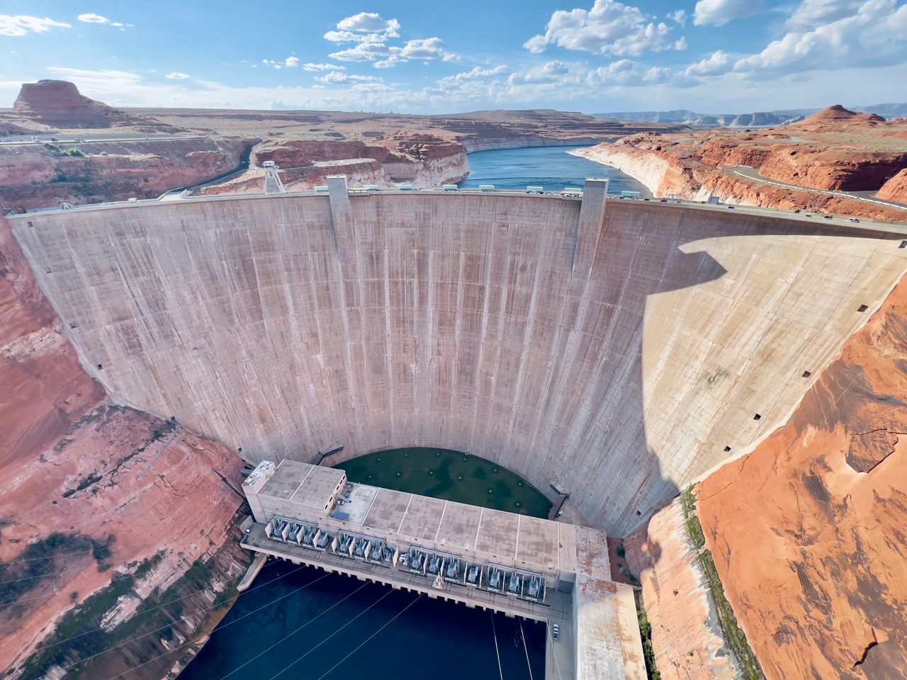
In 1956, the Bureau of Reclamation chose Glen Canyon as a dam site. The decision was made partly because the Sierra Club, fighting to protect Dinosaur National Monument upstream, accepted Glen Canyon as a compromise. David Brower, who led that campaign, later called it the greatest conservation mistake of his life.
Glen Canyon Dam was completed in 1966. Lake Powell rose and drowned 186 miles of red-rock canyon between Lees Ferry and the present Utah-Arizona border, a labyrinth of alcoves, side canyons, and sandstone walls that most Americans had never seen and would never see again. Edward Abbey had floated the canyon in its final years and wrote about it in "Desert Solitaire" (1968). He called it "the place no one knew."
The Colorado above the reservoir still runs free. Near Cisco, a hundred miles upstream of the reservoir's fluctuating edge, the river accelerates through Westwater Canyon, a short, rapid-filled gorge of billion-year-old granite, accessible by a dirt road from I-70. That is the water this page is watching.
Built water, new currents
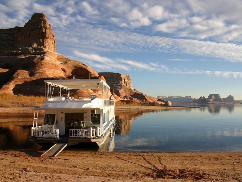
The dams that drowned Glen Canyon and flooded the Green's upper reaches also built something else. Below Glen Canyon Dam, the cold, clear release at Lees Ferry became one of the most famous fly fishing reaches in the country. Lake Powell itself, the reservoir that swallowed "the place no one knew," is now one of the busiest houseboating destinations in the West.
Upstream, Flaming Gorge Dam did the same to the Green, turning a desert river into a blue-ribbon trout fishery. Meanwhile the stretches that escaped the dams, Westwater, Cataract, and Desolation, remain wild enough that permits are some of the hardest to draw in American rafting.
What the gauges see
Powell had no way of knowing what waited around the next bend. Today, more than 8,000 gauges operated by the United States Geological Survey monitor river levels continuously across the country. Most update every 15 minutes. Every reading on this page (flow in cubic feet per second, stage height, water temperature) comes from instruments Powell would have traded everything to have.
The gauges don't change the river. They just make it legible.